Timeline
Work History
Overview
Education
Skills
Summary
Work Availability
Quote
Software
Languages
e5
Mvano Rashid

Mvano Rashid

Geospatial Consultant & Information Designer
Dar es Salaam,02

Timeline

UI/UX Designer/System Developer Consultant

VTTO Tanzania
11.2024 - 02.2025

Data Quality Control and Mapping Expert

National Bureau of Statistics Tanzania(NBS)
01.2024 - 09.2024

System Development Technical Lead(Tech Lead)

Sahara Ventures
11.2023 - 12.2023

Atlas Map Designing Expert (Team Leader)

National Bureau of Statistics Tanzania(NBS)
06.2023 - 09.2023

GIS Developer Consultant(GIS Trainer)

Eastern and Southern African Management Institute
09.2022 - 10.2022

GIS/Mapping Consultant

Rafiki (Coffee) Ltd
02.2022 - 03.2022

GIS Developer and Remote Sensing - Consultant

Energio Verda Africa
09.2021 - 01.2022

Information System Assistant (GIS)

IOM - International Organisation for Migration
10.2020 - 03.2021

Data Conversion staff(GIS Data Manager)

IGNFI - Tanzania
02.2018 - 05.2019

No Degree - Short Course On Monitoring And Evaluation(M&E)

University Of Dar Es Salaam
02.2018 - 02.2018

GIS Speacialist

SMEC Tanzania
02.2017 - 01.2018

Bachelor of Science - GeoInformatics (Bsc GI)

The University of Dodoma
10.2013 - 11.2016

No Degree - A - Level Education

Mbezi Beach High School
03.2011 - 05.2013

No Degree - O – Level Education

Biafra Secondary School
01.2007 - 11.2010

Work History

UI/UX Designer/System Developer Consultant

VTTO Tanzania
11.2024 - 02.2025
  • Conducting research interviews and surveys to understand user needs, pain points, and user’s
    behaviors
  • Creating user flows/journey maps to illustrate how users will navigate and interact with the product.
  • Conducting usability tests to ensure the design is intuitive and meets user expectations.
  • Analyzing feedback and making design improvements based on user’s feedbacks.
  • Designing user interface structures and interactions with a focus on user experience and functionality
  • Building low and high-fidelity wire frames to visualize the user interface structure and flow
  • Ensuring the responsive design and accessible to users with disabilities
  • Prepare presentation and explaining design decisions and user research findings to stakeholders
  • Using analytics and user feedback to continually refine and improve user experience/interface design

Data Quality Control and Mapping Expert

National Bureau of Statistics Tanzania(NBS)
01.2024 - 09.2024
  • Utilizing GIS techniques and capability to perform data wrangling using ArcGIS software
  • Examine and Optimizing and assure the quality of output data by re-digitizing, and corrects all errors
  • Preform attribute level error checking, topological error check and validation
  • Design and develop Spatial Database for data Updates
  • Designing and produce high quality maps that fits all standards and specifications of the organization.
  • Successfully checking and validating more than 20 Regions Administration Boundary by using only
    80% of the project life time.
  • Implementing new workflow that resulting improving data quality check by more than 30%

System Development Technical Lead(Tech Lead)

Sahara Ventures
11.2023 - 12.2023
  • Led a team of developers to successfully deliver high-quality software projects on time and within budget constraints.
  • Coordinated with cross-department teams like QA, DevOps, and Support to ensure seamless end-to-end software delivery process.
  • Enhanced system performance with thorough code reviews, debugging, and optimization techniques.
  • Maintained close communication with clients throughout project life cycles for accurate progress reporting and prompt issue resolution.
  • Provide mentor ship to developers and ensure that the team adheres to coding standards and best practices
  • Define and manage project timelines, milestones, and deliverables.
  • Coordinate with product managers and other teams to ensure alignment with system's requirements
  • Ensure that the system is properly tested,both unit,integration testing, and user aceptance testing (UAT)
  • Take a hands-on approach to resolve technical roadblocks or issues during the development cycle.
  • Define and manage project timelines, milestones, and deliverables.
  • Provide progress reports, gather feedback, and align the team on changes or updates to requirements

Atlas Map Designing Expert (Team Leader)

National Bureau of Statistics Tanzania(NBS)
06.2023 - 09.2023
  • Leading the team and ensuring both pre-processing adn post-processing of relevant and high-quality data
    to create,effective and accurate maps with effective storytelling.
  • Leading and managing a team and Providing direction and support to ensure high-quality output.
  • Providing training, mentor ship, and professional development opportunities to help team members grow
    their skills in Atlas mapping tools and methodologies.
  • Providing advance trains for the team on effective utilization and integration of ArcGIS Desktop, ArcGIS Pro, ArcGIS online, ArcGIS App Builder Tool and Adobe Illustrator for the professional production of both Dynamic(Enteractive) and static map Production.
  • Managing and overseeing the use of mapping tools and platforms to ensure effective use as well as
    troubleshooting any technical challenges across the team.
  • Communicating findings, progress, and results to key stakeholders, ensuring they understand the value
    and insights provided by Atlas maps.
  • Continuously evaluating and selecting the best tools for Atlas mapping, ensuring that the team is using the most efficient and relevant technologies for their work.

GIS Developer Consultant(GIS Trainer)

Eastern and Southern African Management Institute
09.2022 - 10.2022
  • Designing and creating comprehensive training materials, such as user manuals, slide decks, and step-by-step guides related to the topic.
  • Conducting training sessions on both basic GIS server,Geodatabase management concepts and
    Implementation of ArcGIS for administrator system within organization
  • Conducting training session on the installation and configuration of ArcGIS and ArcGIS serversoftware,
    ensuring all necessary components are set up correctly and efficiently.
  • Conducting training on how to Managing user accounts, permissions, and roles within the ArcGIS platform.
    Ensuring appropriate access control to ensure security and proper functioning.
  • Monitoring the performance of ArcGIS tools and resources, providing guidance to users on how to
    maximize the software's performance based on the organization's infrastructure.
  • Conducting training on database management, spatial data accuracy, or automated workflows using
    ModelBuilder or Python scripting.
  • Conducting a practice session on Implementing, configuration and managing ArcGIS for server and
    its components while utilizing all Analysis capability, data sharing ,management and data migration
  • Providing management with reports on training outcomes, user progress, and the overall effectiveness
    of the ArcGIS training program.

GIS/Mapping Consultant

Rafiki (Coffee) Ltd
02.2022 - 03.2022
  • Evaluated client needs and expectations, establishing clear goals for each consulting engagement.
  • Liaised with customers, management, and sales team to better understand customer needs and recommend appropriate solutions.
  • Collaborated with cross-functional teams to successfully deliver comprehensive solutions for clients.
  • Managed client relationships through regular check-ins and updates on project progress.
  • Preparation of GIS need assessment documentation based on the company day to day activities
  • Advice and equipped the data unit the best data collection strategy for the effective data use
  • Advice and Equipped data unity o the best tools and resources for the effective spatial data collection
  • Provide technical GIS taring on using and manage data using Both Open source and commercial GIS
    Software
  • Training all data collection team members on how to use KOBO, Hand held GPS and Survey 123
  • Conducting practical training on effective utilization of GIS technology for Farmer data managements

GIS Developer and Remote Sensing - Consultant

Energio Verda Africa
09.2021 - 01.2022

Working as Geospatial consultant to assist company on design and development GIS-Machine learning model
and algorithm for palm tree feature extraction from satellite images and analyses and validate extracted data for the visualization process on the web.

  • Collecting ,pre-processing,post-processsing of high resolution images for the feature extraction process
  • Prepare and developing CNN‑Based Tree Crown detection model using python Open-CV liblary
    using Multi‑class Oil PAlm Detection (MOPAD) to count oil palm trees and classification.
  • Using Spectral Information from the satellite images to detects and classifying oil palm tree base on age
  • Extract more than 10 million palm trees features, analyses and validate for visualization process
  • Design back-end Infrastructure for data storage using Postgres/PostGIS database
  • Design and develop Font-end Application with HTML/CSS, Leaflet.js for web-maping
  • Inter-grate Back-end and font-end with the use of Express-REST API for data visualization and
    accessibility
  • Training all data collection team members on how to use KOBO, Hand held GPS and Survey 123
  • Deploying Web-Mapping Application to the server for production process
  • Successfully develop Machine learning model with 92% Accuracy
  • Using python to automate the Analysis and increase the efficiency by 98%
  • Successfully design and deploy web mapping application 5 day before the deadline day

Information System Assistant (GIS)

IOM - International Organisation for Migration
10.2020 - 03.2021

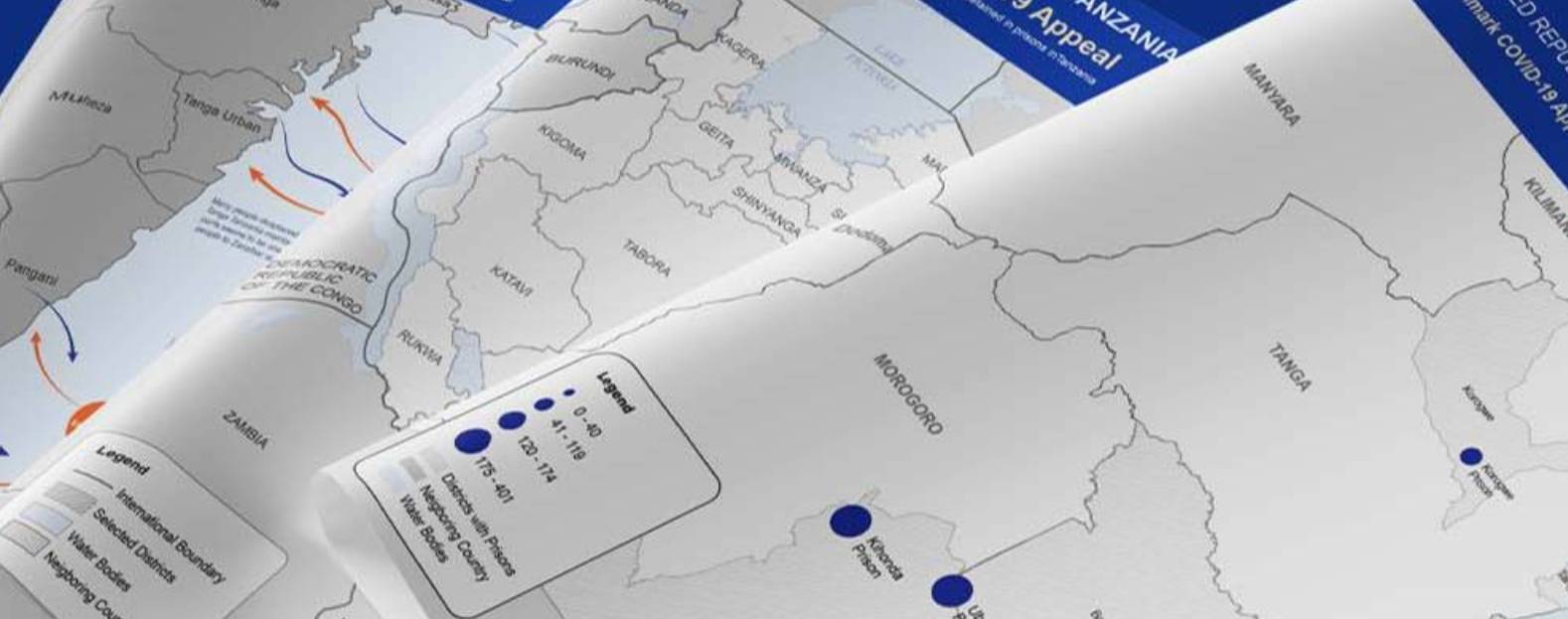
Employed as Information System Assistant (GIS) to help organization on mapping, analyzing and visualizing
displacement tracking matrix (DTM) migration data, managing and monitoring DTM database and DTM server
and mapping and monitoring all points of entry(PoE) across the country and Reporting.

  • Strategies data collection tools and techniques and provide training for enumerator team
  • Production of GIS related products for operational, information sharing and dissemination
  • Take parts on the design, development, and systematic maintenance of relevant Spatial data infrastructure to facilitate management of spatial data in the country.
  • Assist monitoring DTM data standards to follow during the data collection by providing the necessary guide and instruction to the enumerator team.
  • Analyze, visualizing and telling story about displacement people using data visualization and info graphics.
  • Prepare visual report(dashboard) for stakeholder sharing, and Design and produce high quality Maps for the DTM project and other Department Unity
  • Identify needs and advise on gis/mapping tools, technology and products

Data Conversion staff(GIS Data Manager)

IGNFI - Tanzania
02.2018 - 05.2019

Employed as Data Conversion staff(GIS Data Manager), helping Company on preparing data for the Installation and development of Integrated Land management System (ILMIS) as a pilot study of ILMIS project for Three Districts of Dar- Es Salaam Region.

  • Data entry, indexing in the system for the further processing
  • Perform data quality check and control for the non-spatial data in enterprise system
  • Extract more than 10 million palm trees features, analyses and validate for visualization process
  • Geo-referencing scanned topo maps, survey map and cadastral map for the further conversion
  • Design and prepare model with graphical model builder in qgis environment
  • Digitizing and entry required records using QGIS software
  • Preform data quality check and validation by using qgis and customized plug-in tools

GIS Speacialist

SMEC Tanzania
02.2017 - 01.2018

Worked as GIS analyst as the part of Survey & Designing team supporting company on designing and mapping Electric distribution Networks and preparation of Bidding documents for the REA Project.

  • Perform field data collection with Hand held GPS and Mobile GIS Data collection tools.
  • Using Google Earth pro to capture High resolution images and georeference them in ArcGIS
  • Design and create model with ArcMap Model Builder for automate design process
  • Electric supply Network design using ArcGIS and produce higher quality Cartographic Maps
  • Preform Data Quality Control and Validation and Bidding documents for submission.

Overview

8
8
years of professional experience
9
9
years of post-secondary education

Education

Bachelor of Science - GeoInformatics (Bsc GI)

The University of Dodoma
Dodoma,Tanzania
10.2013 - 11.2016

No Degree - Short Course On Monitoring And Evaluation(M&E)

University Of Dar Es Salaam
Dar Es Salaam
02.2018 - 02.2018

No Degree - A - Level Education

Mbezi Beach High School
Dar Es Salaam
03.2011 - 05.2013

No Degree - O – Level Education

Biafra Secondary School
Dar Es Salaam
01.2007 - 11.2010

Skills

  • Communication skills
  • Teamwork and Collaboration Skills
  • Problem-Solving and
  • Critical Thinking Adaptability and Creative Skills
  • Analytical and Decision-Making Problem-Solving and
  • Critical Thinking Adaptability and Creative Skills
  • Analytical and Decision-Making
  • Data collection and Management
  • Data Analysis and Modelling
  • Data Analytics and Visualization
  • Data Design and Reporting
  • UI/UX Design and Illustration
  • GIS and Cartography
  • Remote sensing and Data maning
  • System Design and Development

Summary

Geospatial Data Scientist and Information Designer with over seven(7+) years of working experiences in data science, spatial analytics, and geospatial modeling, with a proven track record of working with large-scale geospatial datasets, applying statistical and machine learning methods to create predictive models, and delivering insights that support key business decisions. Experienced in integrating geospatial analysis with data management systems to optimize resource allocation and improve operational efficiency. Proficient in Python, SQL, GIS, and cloud-based platforms, with a strong ability to communicate complex data findings to both technical and non-technical audiences.

Experienced Data Strategist with a deep understanding of data management, analytics, and business intelligence. Adept at designing and implementing data-driven strategies to optimize operations, enhance customer experiences, and support long-term business goals. Expertise in data visualization, machine learning, and data governance, with proven track record of using data to solve complex business challenges, improve efficiency, and foster innovation in fast-paced environments while maintaining global data standards, the EU Data Regulation (EUDR), and data governance for managing data securely, ethically, and in compliance with Tanzania and international laws.

My career has been centered around translating complex data into clear, actionable insights through visual design, as well as crafting intuitive, user-friendly digital experiences. I possess a deep understanding of the intersection between data and design, ensuring that my work not only delivers meaningful insights but also resonates with users across diverse platforms.

Work Availability

monday
tuesday
wednesday
thursday
friday
saturday
sunday
morning
afternoon
evening
swipe to browse

Quote

Everything you’ve learned in school as obvious becomes less and less obvious as you begin to study the universe. For example, there are no solids in the universe. There’s not even a suggestion of a solid. There are no absolute continuums. There are no surfaces. There are no straight lines.
R. Buckminster Fuller

Software

Esri Mapping Products

QGIS,PostGIS

Adobe Product Suite

Python and JavaScript

HTML & CSS

Microsoft Package

PowerBI,Tableau

Languages

English
Bilingual or Proficient (C2)
Swahili
Bilingual or Proficient (C2)
Mvano RashidGeospatial Consultant & Information Designer